Trogluddite Posted January 24, 2015 Share Posted January 24, 2015 (edited) ^^ So good to see the word "recce" again! I don't believe I've ever heard it in casual conversation and if I heard while watching "The Dessert Rats" I've forgotten - is it "rek-kee?" as to pronunciation? Edited to add: I don't want to combine a land and sea visit to lovely Canada because no good ever came out of getting on a boat, particularly one that's surrounded by water. Edited January 24, 2015 by Trogluddite Link to comment Share on other sites More sharing options...
BC witness Posted January 24, 2015 Author Share Posted January 24, 2015 (edited) Trogluddite, as a long ago member of Her Majesty's Royal Canadian Army, Signals Corps, recce, pronounced "reh key", was part of my daily language. I do recall "Desert Rats", but don't remember that term being used on the show, but there are a lot of things I don't remember these days. My mental hard drive is so full of useless trivia from decades past, that a "deep search" takes a long time to come up with an answer. ;-) ETA: As a "War Baby" transported to Canada from Britain aboard the Mauritania (Sistership of the ill fated Lusitania) in 1947, and as a long time pleasure boater on BC's incredible coast, I take your comment with a huge grain of salt. Boats are the very reason that we (all non-native North Americans) are on this continent, so I love boats, in all forms and sizes. Edited January 24, 2015 by BC witness Link to comment Share on other sites More sharing options...
Trogluddite Posted January 24, 2015 Share Posted January 24, 2015 ^^ God bless you - we had some Canucks with us in an ugly country I'd prefer to forget and unfortunately, they got hit just as soon as they got in country. I don't know where I picked up the phrase, but it was probably from some black-and-white movie. Link to comment Share on other sites More sharing options...
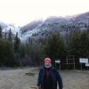
BC witness Posted January 26, 2015 Author Share Posted January 26, 2015 AAR for Sun., Jan. 25This was a short day trip, with Magni riding shotgun, and Thomas and J in his Explorer, to scout a local trail that I had never run, in 50 years of backroading. I didn't know any of those existed within 2 days drive of me! We headed out at 0800, with clouds, but the 2 day downpour had ended about midnight last night, so we hoped for no washouts.We met up in Mission at Thom's, who was the only one who had run the trail before, and headed east on Hwy 7 about 40 min. to a small settlement on First Nations land ( the PC term for the rez), and found the trail start. It was because of it's location on the reservation, that I had never noticed the trail before, as it's not signed at the Hwy, and looks like a driveway into a business. The FSR (Forest Service Road) starts to climb immediately from 60' ASL at the turnoff, to about 1200' by km 4, then contours the valley for 5 km, and once again climbs steeply for another 5 km, topping out at about 2600' at the point where it crosses a gap in the mountain, and becomes **** FSR, and descends to Hwy 1 a few km east of the town of Hope. We were unable to complete the loop down, as we hit deep, wet snow at the pass, and were not equipped for that, as I don't yet have the right size chains for the truck ( I'm waiting to buy them after I do the lift and upsize to 31-32" tires), and my Hankook ATs weren't cuttin' it in that stuff. The road was in pretty good condition, considering the deluge we've had the last couple of days, and the rain made the surface soil soft enough to show tracks, had there been any. We did a short hike at the top of the pass, but the soggy snow made for pretty tough going, so again there were no prints found, other than our own. At that point we turned around, and trekked back out to the start point, then headed back to our favourite greasy spoon, in Matsqui, for a good lunch, and to make plans for a more extensive run up this road later in the year. Link to comment Share on other sites More sharing options...
NathanFooter Posted January 26, 2015 Share Posted January 26, 2015 This is a fantastic thread, great stuff guys. This is the kind of stuff that the community needs, I am really looking forward to the next set of trip notes and photos. Link to comment Share on other sites More sharing options...
gigantor Posted January 26, 2015 Admin Share Posted January 26, 2015 (edited) I wish I lived in the PNW. For what it's worth, the SSR has some sighting reports around the area, but they have not been classified yet (except for one - the yellow dot). That's why the rest of the placemarks are purple... Edited January 26, 2015 by gigantor Link to comment Share on other sites More sharing options...
MikeZimmer Posted January 26, 2015 Share Posted January 26, 2015 Magniaesir and I got together for a combined road trip, Sasquatch search, and hunting safari today. We set off at 8AM, headed 1.5 hours east, then spent the rest of the morning on a muddy, rutted logging road, looking for tracks of deer (both types open, bucks only), black bear, spike/fork moose, and large hairy bipeds. We not only found zero critters, we found zero tracks, too. This was a surprise, as the road surface was soft from a week of rain, and should have shown where animals were crossing. After heading out to Merrit for lunch, we spent the afternoon on the plateau where I got the bear a month ago, with the same negative results over about 40 km of dirt roads. We were back home for supper by 7:30, tired, dirty, hungry, and glad to have had a day out in the woods. Next weekend is a campout with several other local researchers. BC witness, I have recently spent a lot of time on Google Earth looking at that polygon bounded by Princeton on the east,, Hope on the west, the Coquihalla and Merrrit in the North. It gets progressively drier towards the east and north - and more open. Have you used that as a search area? I did not see too many reports from in there, but did find one or two if memory serves me. Have you spent much time in that area? I am not sure which plateau you might be referring too, since I rarely get a chance to back-road around there. I get over to Merrit once or twice a year, and have for over three decades, when vacationing. Link to comment Share on other sites More sharing options...
BC witness Posted January 27, 2015 Author Share Posted January 27, 2015 Mike, that whole area has been my main deer hunting region for a little over 50 years. I've explored every road there (I think, they keep closing old ones, and adding new) from the US border at the Pasayten Wilderness to the old Hudson Bay Co. trading route through the headwaters of the Whipsaw Creek. Of course, all the land within Manning Park is closed to hunting, so that's a huge chunk of acreage that I haven't bothered with. There are sighting reports right at the edge of Princeton, one being just yards from the old bridge, on the old KVR roadbed, just below the airport. Another area with several sightings is the Ashnola Valley, east of Princeton. I try to get several weekends every fall to spend at Placer Mt./Lake, Whipsaw, Sunday Summit, and China Mt. Come to think of it, I read a report of a sighting right at the primitive campsite at Placer Lake. The plateau I mentioned near Merrit is the area between the Merrit-Spences Bridge road, and the Logan Lake - Ashcroft road, north of the Highland Mines open pit operation. Access is from Aberdeen road, out of Lower Nicola. Link to comment Share on other sites More sharing options...
MikeZimmer Posted January 27, 2015 Share Posted January 27, 2015 Mike, that whole area has been my main deer hunting region for a little over 50 years. I've explored every road there (I think, they keep closing old ones, and adding new) from the US border at the Pasayten Wilderness to the old Hudson Bay Co. trading route through the headwaters of the Whipsaw Creek. Of course, all the land within Manning Park is closed to hunting, so that's a huge chunk of acreage that I haven't bothered with. There are sighting reports right at the edge of Princeton, one being just yards from the old bridge, on the old KVR roadbed, just below the airport. Another area with several sightings is the Ashnola Valley, east of Princeton. I try to get several weekends every fall to spend at Placer Mt./Lake, Whipsaw, Sunday Summit, and China Mt. Come to think of it, I read a report of a sighting right at the primitive campsite at Placer Lake. The plateau I mentioned near Merrit is the area between the Merrit-Spences Bridge road, and the Logan Lake - Ashcroft road, north of the Highland Mines open pit operation. Access is from Aberdeen road, out of Lower Nicola. Thanks for the information. I have only been into that area north of the highland mines once, and don't ask me how I got there now. I was trying to back road it from Merritt to Kamloops as I remember, or maybe going in the other direction. Merritt is not much of a town, but I love it anyway. We used to trek up there every thanksgiving, just for a trip, to see some fall colors, and eat at the Home Restaurant, or maybe visit the Quilchena Hotel and Trading Post (hope I am remembering those names correctly). Link to comment Share on other sites More sharing options...
BC witness Posted January 27, 2015 Author Share Posted January 27, 2015 The lunch stop that I mentioned Magniaesir and I making on that trip was at the Home Resteraunt, of course, and yes, you have the names right. The Highland plateau now has vast clearcuts, due to the Pine Beetle infestation of the last decade or so. That applies to much of the interior of the province, from the Okanagon valley in the south, to north of Prince George. It's had a huge effect on the ecology, and the economy. Link to comment Share on other sites More sharing options...
MikeZimmer Posted January 29, 2015 Share Posted January 29, 2015 I wish I lived in the PNW. For what it's worth, the SSR has some sighting reports around the area, but they have not been classified yet (except for one - the yellow dot). That's why the rest of the placemarks are purple... BC1.PNG Pacific North West (PNW). Hey we call it the Pacific Southwest here in Canada. OK, I am kidding, we call it the lower mainland. Link to comment Share on other sites More sharing options...
daveedoe Posted January 30, 2015 Share Posted January 30, 2015 It was such a beautiful day I headed into the Gifford Pinchot NF up Panther creek and a short hike up Trapper Creek. I thought I would look for any tracks I could find. Did not see many tracks other than deer and small critters. I did see one deer munching in someones lawn near Carson Wa. I was as high as 4000 ft elevation no trace of snow anywhere. This winter here has been more like spring. Its been in the fifties up in the hills. I think the snow has been only falling on the volcanic peaks above 4000 ft. I took a few photos the first one is through the trees looking toward Soda Peaks where a friend and I herd a vocalization back in 1989. I found a bunch of trees on one road that were either snapped or uprooted. I tried to figure what caused the tree for about a mile and a half to be across the road. Could not have been wind because it was only localized to the road. No snow this year so that was out. The thing was some were downed from the uphill side and about as many from the downhill side, all crossing the road. Most had been cut off for so vehicles could pass through my guess is the forest service. The only thing I could think of was we did have a good soaking rain and maybe the trees just fell. Or maybe there was a Bigfoot ripping them down and saying stay out of here. 1 Link to comment Share on other sites More sharing options...
BC witness Posted January 30, 2015 Author Share Posted January 30, 2015 Dave, those downed trees look very much like what we saw last Sun, on a drive along Hwy 7 in the Fraser valley. There were many hundreds down for several miles along the road, on both sides. The cause was a severe freezing rain event a couple of weeks ago, so much ice built up on the branches that the weight became too much for the root systems in some cases, and for the individual branches, or trunks, in others. The small settlements along that section had no power for days, so many lines were down. Later in the day, up the drainage we were checking out, we found no snow below 2500', and no sign that the ice storm had hit at elevations higher than the valley floor. I'm lovin the mild weather so far this winter, we've had 3 outings, on nice days, since new Years Day. Link to comment Share on other sites More sharing options...
daveedoe Posted January 30, 2015 Share Posted January 30, 2015 MIght have been ice but it would have had to have been in a very localized area. The odd thing was how some were just snapped and others uprooted. The downed trees were about a every hundred yards or so for about a mile and a half. Just seemed odd to me. I tried to make a reasonable conclusion to why the trees were uprooted or snapped. If the ground was soaked some of the trees could have been uprooted by a human but the snapped off ones no human could have. I just thought it interesting to see these in such a small area across the road and no where else. I was passing through about 2500 ft elevation maybe there was an inversion with cold air trapped causing freezing rain in that area. Maybe just a microclimate there. The problem is we just have not been cold enough this year and I should have seen more. I did cover about 50 miles passing through that elevation in different locations. I will just go with weather related. The only thing on this field trip I saw as unusual. Link to comment Share on other sites More sharing options...
daveedoe Posted January 30, 2015 Share Posted January 30, 2015 (edited) took my Granddaughter searching for the elusive Bigfoot today . We went up to Mt St Helens could not get to several of my favorite spots because of gates locked for winter, it was not because of snow. There was no snow at any of the snow parks. We did see a few souls climbing today, was an excellent day to climb and ski down. We searched for wildlife tracks again did not find many. One thin it was warm 56 degrees. Here are a few pictures we did explore one of the lava tubes, in the tale of two forests. Please forgive my grammatical errors Edited January 30, 2015 by daveedoe Link to comment Share on other sites More sharing options...
Recommended Posts