BC witness Posted May 16 Author Posted May 16 It's probably been 30 years since I was last at Koocanusa. Great country, but long road trips are scarce these days since my wife can no longer handle those. 1
Catmandoo Posted May 17 Posted May 17 On 4/13/2025 at 5:58 PM, Trogluddite said: Thanks. I was surprised at how infrequently this topic came up on the Forums. Using the search button, enter "locator", do not use the words 'personal' or 'beacon'. Your options depend on how much you want to spend. If you have not purchased a unit(s) yet, REI has some sales currently.
langfordbc Posted June 8 Posted June 8 @norseman Cool. I'm down in that country (north of the border) for the first time in my life this week - the last part of BC I haven't spent time in. A few days of work in Cranbrook and Fernie, about 100 miles north of Kalispell. Man, it is beautiful down here. 2
Madison5716 Posted June 16 Posted June 16 On 4/13/2025 at 7:47 AM, Trogluddite said: Question from an amateur - any recommendation for the better satellite emergency communicator, Garmin or Spot or "other"? My wife and I are planning our first hiking trip where I'm concerned about being out of cell service and needing comms in an emergency. (NOTE: This isn't the first trip where I should have had one of these things; it's just the first trip where I'm being a little less dumber than normal.) I always carry my Garmin InReach Mini. I know less about it than I ought. That little SOS button does give me peace of mind... if I or someone else was literally at risk of dying. There's a popular hiker out there recently who had to push the button for rescue and now has a $30k bill.
BC witness Posted June 16 Author Posted June 16 What's the 30K bill about? Here in Canada SAR services are free. Charging for rescue could deter some people from doing so when they should, with possibly deadly consequences.
Huntster Posted June 16 Posted June 16 Here in Alaska, it can go several ways. I've been extracted by emergency. The State Troopers were contacted about me being shot in the wilderness. They contacted a private helicopter EMT firm, perhaps because of the description of my injury (shot in the head). I was billed by the emergency EMT firm, and my health insurance coverage (very reluctantly, and after some coaxing) covered the helicopter and medical issues after the customary deductibles (about $1000). The total bills came to @ $45K (this in 2001). Usually government rescue personnel are sent on attempted ascents of Mt. McKinley that have gone awry, since that's within a national park. A friend broke his back in a snowmobile accident, and the guy who called it in used a radio on an aircraft frequency. He caught an Army Air Guard helicopter in the air, they diverted and picked him up, and delivered him to the hospital.........free of charge. They billed the time to "training exercise". The Coast Guard rarely bills........unless you're an idiot. One guy, on a deer hunt near Juneau, pushed the emergency button on his communications device. When the Coast Guard showed up in a helicopter, he asked if any of them had any cigarettes, that he had run out, and really needed one. He was transported to Juneau and turned over to local police.............
norseman Posted June 16 Admin Posted June 16 58 minutes ago, BC witness said: What's the 30K bill about? Here in Canada SAR services are free. Charging for rescue could deter some people from doing so when they should, with possibly deadly consequences. I had a 25k helicopter bill going from the Colville hospital to the Spokane hospital. I got myself to the Colville hospital by car. Heart attack. We don’t pay the same taxes I guess.
Huntster Posted June 16 Posted June 16 2 hours ago, Huntster said: ........Usually government rescue personnel are sent on attempted ascents of Mt. McKinley that have gone awry, since that's within a national park......... I thought I'd expand on this a bit: Ascending Mt. McKinley has become a big goal for many mountaineers. It's the tallest mountain in North America, but what makes it particularly dangerous is its high northern latitude in addition to its height. Even in mid-summer, temps in its upper regions remain well below zero and are worsened by the high winds. It was only in recent times that an ascent to the top in winter was achieved. Before that, it was suicide, and it remains near suicide. There have been many deaths there, and they occur every year. The first this year was just the other day. The National Park Service and Army Air Guard got pretty frustrated with the dangerous rescues and body recoveries a couple of decades ago, and since the mountain is in a park, they have the ability to highly regulate climbers. The park service began a bonding requirement some 20-25 years ago. This way the government could recoup some of the costs of all those rescues.
Trogluddite Posted June 17 Posted June 17 On 6/16/2025 at 1:43 AM, Madison5716 said: I always carry my Garmin InReach Mini. I know less about it than I ought. That little SOS button does give me peace of mind... if I or someone else was literally at risk of dying. There's a popular hiker out there recently who had to push the button for rescue and now has a $30k bill. Thanks. The Garmin plan was too expensive and too inflexible for my liking, so I went w/Zoleo. The advantage that I can see is that I can basically suspend service for awhile w/out paying outrageous fees. Knock on wood that I don't need it. 1
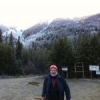
Popular Post norseman Posted July 11 Admin Popular Post Posted July 11 Clear water river, Bull lake, Libby dam, Yaak river Great trip thus far! 1 1 4
Catmandoo Posted July 14 Posted July 14 On 6/15/2025 at 10:43 PM, Madison5716 said: There's a popular hiker out there recently who had to push the button for rescue and now has a $30k bill. Air medivac is deal maker / breaker when I select supplemental insurance. My deductible for an air medivac/ambulance is $350. I was recently talking to a former coworker about medivac costs. He was in a remote part of Alaska, and a medivac to Anchorage was $125K if they could fly. That is a tough pill to swallow.
Skookumchuck Posted August 15 Posted August 15 (edited) So, boring warning. Went to a woo location so no need bothering this forum with that. However great riparian area with at least one class a sighting. A cyclone blew up leading to cloud walls forming over highlands with dangerous winds for prolonged period and occasional explosive lightning. This area is known for this although it was leaving my area of interest. There seems to be an immense awareness even among th locals that there is something different up here. A lone sasquatch of immense powers (which is the woo part). Led to a prolonged sighting at close range elsewhere in the same season. He has been up there likely hundreds of years or, just that a lone male sas. is always living up there. Been up several times as I regained interest, East coast. Found clear evidence of something, this guy like to hide near a main artery and people watch. Somewhat degraded from way back when where I had an interaction. On a cycle trail with bluffs to hide under, over. I found 4-5 wide paths stamped into hiding locations near the trail (also lot of illegals patrols in the area, constantly) stamped into mud and dead ending about 25 to 35+ ft into rich riperian repasts. Also, a sleeping pad about 10X10 ft square, may have been machine cleared but smooth and not one twig, level right next to trail. Perfect for a large hominid to rest in unobserved but near traffic. Like to be out at night in the fields and woods under a full moon. Spring is probably the best time or late winter. Near another area as well even another in Whitehall NY, those are different and seem to be family subgroups seasonal traveling betwee ranges, upland and low land remote areas well protected. Edited August 15 by Skookumchuck sp. 1
wiiawiwb Posted 9 hours ago Posted 9 hours ago On 4/13/2025 at 10:47 AM, Trogluddite said: Question from an amateur - any recommendation for the better satellite emergency communicator, Garmin or Spot or "other"? My wife and I are planning our first hiking trip where I'm concerned about being out of cell service and needing comms in an emergency. (NOTE: This isn't the first trip where I should have had one of these things; it's just the first trip where I'm being a little less dumber than normal.) The two main brands on REI are Garmin and Spot; there seems to be the same options as to range, cost of subscription, etc. Just wondering has practical advice based on usage. As always, much obliged for any thoughts on the matter. It would help if you can describe that type of potential emergency you are concerned about. For example, let's say are concerned if you were to fall and break a leg or twist an ankle and be physically unable to transport yourself out. You're not imminitely in danger but need help. A satellite communicator such as Garmin or Zoleo works perfectly. You can describe by text your inability to extract yourself and a family member or friend could come to help you out or summon SAR if necessary. If, however, you are concerned with something catastrophic, such as a heart attack, venomous snake bite, or severe laceration where time is of the essence, I'd suggest also having a PLB ( personal locator beacon). I have both and always carry them. In a catastropic event, you may be close to unconciousness and may be unable to text a message. In that case, you want able able to press a button and know the cavalry is on its way. A PLB is more reliable for that than a satellite-messenger device, in my opinion. By having both, you can reach SAR using the PLB and then text the nature of your problem with the Garmin/Zoleo. That would enormously benefical so SAR is apprised of the nature of your problem. I have preset messages on my Garmin that briefly describe the nature of the problem. For example, one message on my Garmin says, "I've been bitten by a venomous snake, may lose consciousness and have alerted SAR on my PLB." That way, they know the problem, they know the PLB alert has been activated and can coordinate things properly. Here is someone who has lots of valuable information regarding communicator devices and this video is where I got the idea to coordinate things between a PLB and Garmin device. I've started the video at the end in the Recommendations" section.
Trogluddite Posted 2 hours ago Posted 2 hours ago ^^^ Thanks wiiawiwb. Despite breaking an arm 2 miles into the woods, my wife and I have not carried any type of locator even though many hikes in the Adirondacks and Catskills have pockets of no cell service. We're going up to Banff shortly and the first thing I read was "don't expect to have any cell service." I went with a Zoleo as an emergency communication system in the event of something bad - whether it be a hobbling twisted ankle that requires more assistance than my wife can provide or being et by a 1,000 grizzly bear. My wife is trained on using it, so if one of us goes down, the other one is the communicator. If it's really bad (like the recent rock slide in Banff that killed a few hikers), well xin loi.
Recommended Posts