Leaderboard


Popular Content
Showing content with the highest reputation since 06/25/2026 in Posts
-
Thanks for sharing. The story is one I find very interesting. Hunster provided me with some information awhile back.1 point
-
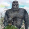
Since this also seems to be a current thread where the Morris suit is being discussed, I just put up two posts in the Patterson-Gimlin Film reference section. Basically, they go through Chapter 24 of Greg Long's book The Making of Bigfoot (so others don't have to suffer) and breaks out every specific item of information that Philip Morris stated about his suit. Some of those points don't necessarily shed any light on the issue when taken individually; others - to my mind - make it clear that Patty is not a person in a suit. No proponent of the PG film should jump to the conclusion that Philip Morris is lying. He could just be completely wrong. Interestingly, he could also be write on the details of Roger ordering a suit, but he could be wrong about when that happened. For example, if Roger and Al DeAtley were trying to recreate the P-G film for use in a future project, part of Mr. Morris's recollections could be correct.1 point
-
Does he want it back? 🔥1 point
-
They can't even get the state it was taken in correct. And oddly enough, they say that the JACOB'S photos were taken by someone by the name of Wilson. More internet slop.1 point
-
It was Bob Heironimus.1 point
-
It's neither here nor there, but I'd like to again point out Heironomous claims he was to be paid $1000 for his supposed stroll in a bigfoot costume. That's a ridiculously high sum of money.
 1 point
 -
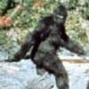
Is that not just after frame 352? That is the exact rock/stick formations from Bluff Creek, the 66 footage isn’t in Bluff Creek from what I’ve read. Just looks like a filter over the Patterson footage.1 point
-
so is this supposed to be pro PGF or pro capturing sasquatch?1 point


This leaderboard is set to New York/GMT-04:00