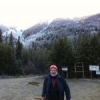
Two weeks ago, I spent a week in the High Uinta Mountains of Utah, camping and hiking with some friends.
It is a beautiful area with easy access to high alpine lakes from the Mirror Lake Scenic Byway (Hwy. 150).
While the trip was not a BF focused trip, I was fully aware of several BF reports around several of the lakes we visited.
I also was aware of the claim by some Utah BF researchers, that the Weber River drainage was a hot-spot.
Thus, I decided to take one my hikes overlooking the Weber River drainage and to follow a similar path as one of the BFRO reports (see link below).
http://www.bfro.net/GDB/show_article.asp?id=188
In this report, two men and their 5 boys, claimed to have hiked to the top of the ridge between Pass Lake and Cuberant Basin at the head of Weber River drainage.
When they reached the top of the ridge they looked down upon a small alpine lake about one half mile below and saw the BF like creature standing on its edge.
While I don't know exactly where they were, if they were at the ridge above Cuberant Lake, that was about 11,000 ft and Cuberant Lake was down at 10,400 ft.
I did not climb the ridge. Instead I followed the trail from Pass Lake to the largest of the Cuberant Lakes in order to see the Weber River drainage to my west and check out one pond and 2 of the Cuberant Lakes.
Below is a map extract showing were Pass Lake TH, Cuberant Lake, Fish Lake and Notch Mountain are located.
That morning it was 48 F at 9:30 AM and had rained all morning. Thus the dark clouds on the photos. It did not rain anymore until after 2:30 PM.
The first photo is of Notch Mountain and the 2nd photo is an unnamed mountain. Both of these were to the west of our position and you can see the Weber River drainage down below.
The 3rd photo shows the hike down from the pass into the pond on the way to the Cuberant Lakes.
Fourth photo is the first Cuberant Lake and the 5th photo is the largest of the Cuberant Lakes.
Overall the whole area is beautiful and I will probably return (with a backpack and to go deeper).


